
Locals and GPS systems can lead you to the oddest places
Cycling to Pierre-St-Martin
Marie Eclaire (as I call the women's voice on my car GPS system), took me on a 4-wheel-drive farm road today. I was certain I was going to end up in some farmer's barn, wearing lycra, and wondering if it would be acceptable to ask if I could stay for a morning cup of coffee. Later Marie Eclaire successfully navigated me through the town of Oloron-Saint-Marie (another one of those towns where I often get lost), proving her worth.
I arrived at my destination of the small town of Arette, after wandering around the morning market in Oloron-Saint-Marie. Arette is a wonderful town. It has a couple of nice cafes, and lots of cyclists riding through town on the D918. The D918 is a great scenic road. As I was starting my climb in Arette, I saw a large group of cyclists passing through town. They were all wearing the same yellow and green jerseys, 7 hours later, I saw these same jerseys climbing up the Col d'Aubisque. God knows where those poor souls are now.
*Note: I think they are almost finished repaving the road up the Col du Soulor across to the Col d'Aubisque. There is lots of gravel however, and sadly all the history of the white painted names of the Tour de France are wiped away every time they repave a road. I wonder who will paint the first "Lance" across the new road.
Today's climb was suggested by a local I had met the other day on the Col d'Ichere. He pointed to the climb on my map and told me it was very difficult. About a third of the way up the climb I found the difficult 15%. My Michelin map actually had a tiny 15% printed on the map, I don't see that often. I rode from Arette up to the Col du Soudet to Pierre-Sainte-Martin.
I had heard early rumors that this 22Km climb would be included in the 2010 Tour de France, in the end it was not. It is a tough one. Lots of 9.5% and 10%, plenty of 12% and a section of 15%. This is not a climb I would recommend on your first, second, or even third trip to the Pyrenees. But I am wanting to ride new areas, or ride the climbs I have ridden before from the other direction.
This climb is one of the obscure out of the way climbs like the Col d'Izoard, or the Cormet de Roseland (both in the Alpes). What these climbs have in common are nice towns at the bottom but not much at top. Col de Soudet has Arette, Cormet de Roseland has Beaufort, Col d'Izoard has Briancon.
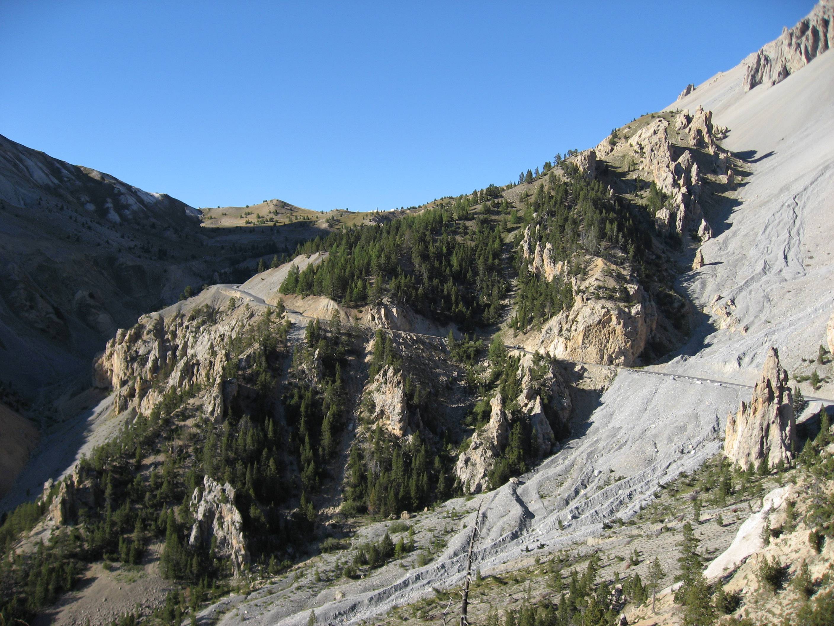
The climb to Pierre-St-Martin is also one of the climbs that ends at a ski station. Expect any climb ending at a ski station to be deserted in June. Ski stations are not attractive. This climb was a forested climb for much of it, with few riders. I saw a friendly pod of 3 Germans coming down the mountain as I was nearing the top. I saw them again in the cafe in Arette after the ride. They greeted me warmly with smiles (crazy American woman riding these big climbs on her own...). It had just started to rain, so I parked my bike next to theirs and enjoyed a nice coffee.
What is not easily recognizable on a map of France is which rides and roads and towns are good and which ones are not. I will be adding lists to help you better plan your trips in the future. For now, I'm busy riding my bike in France, and getting lost. And the Tour de France begins tomorrow!
Images from my day and riding to the edge of France and Spain:


Cycling to Pierre-St-Martin
Marie Eclaire (as I call the women's voice on my car GPS system), took me on a 4-wheel-drive farm road today. I was certain I was going to end up in some farmer's barn, wearing lycra, and wondering if it would be acceptable to ask if I could stay for a morning cup of coffee. Later Marie Eclaire successfully navigated me through the town of Oloron-Saint-Marie (another one of those towns where I often get lost), proving her worth.
I arrived at my destination of the small town of Arette, after wandering around the morning market in Oloron-Saint-Marie. Arette is a wonderful town. It has a couple of nice cafes, and lots of cyclists riding through town on the D918. The D918 is a great scenic road. As I was starting my climb in Arette, I saw a large group of cyclists passing through town. They were all wearing the same yellow and green jerseys, 7 hours later, I saw these same jerseys climbing up the Col d'Aubisque. God knows where those poor souls are now.
*Note: I think they are almost finished repaving the road up the Col du Soulor across to the Col d'Aubisque. There is lots of gravel however, and sadly all the history of the white painted names of the Tour de France are wiped away every time they repave a road. I wonder who will paint the first "Lance" across the new road.
Today's climb was suggested by a local I had met the other day on the Col d'Ichere. He pointed to the climb on my map and told me it was very difficult. About a third of the way up the climb I found the difficult 15%. My Michelin map actually had a tiny 15% printed on the map, I don't see that often. I rode from Arette up to the Col du Soudet to Pierre-Sainte-Martin.
I had heard early rumors that this 22Km climb would be included in the 2010 Tour de France, in the end it was not. It is a tough one. Lots of 9.5% and 10%, plenty of 12% and a section of 15%. This is not a climb I would recommend on your first, second, or even third trip to the Pyrenees. But I am wanting to ride new areas, or ride the climbs I have ridden before from the other direction.
This climb is one of the obscure out of the way climbs like the Col d'Izoard, or the Cormet de Roseland (both in the Alpes). What these climbs have in common are nice towns at the bottom but not much at top. Col de Soudet has Arette, Cormet de Roseland has Beaufort, Col d'Izoard has Briancon.
The climb to Pierre-St-Martin is also one of the climbs that ends at a ski station. Expect any climb ending at a ski station to be deserted in June. Ski stations are not attractive. This climb was a forested climb for much of it, with few riders. I saw a friendly pod of 3 Germans coming down the mountain as I was nearing the top. I saw them again in the cafe in Arette after the ride. They greeted me warmly with smiles (crazy American woman riding these big climbs on her own...). It had just started to rain, so I parked my bike next to theirs and enjoyed a nice coffee.
What is not easily recognizable on a map of France is which rides and roads and towns are good and which ones are not. I will be adding lists to help you better plan your trips in the future. For now, I'm busy riding my bike in France, and getting lost. And the Tour de France begins tomorrow!
Images from my day and riding to the edge of France and Spain:


